


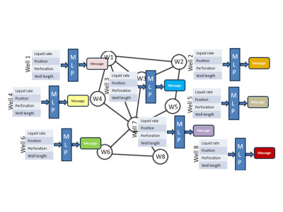
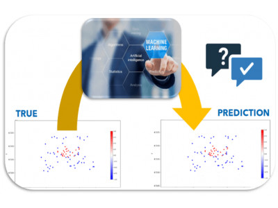
Evaluate if the pressure and the production of wells in an oil field can be estimated with graph neural networks
A comprehensive workflow for managing the multi-step process of producing maps efficiently

Automated execution on large datasets and facilitates stochastic realizations, such as Monte Carlo simulations, to generate probabilistic results
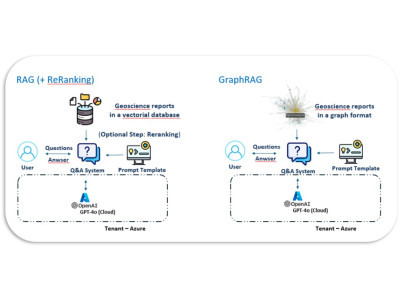
Enhancing geoscience documents mining with LLM through GraphRAG integration and agentic architecture
Developping a robust chatbot that enhances the retrieval and use of geoscientific information
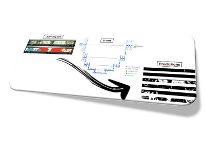
An innovative workflow for semantic segmentation of sedimentological cores using deep learning techniques.
Enriched Clustering Methodology for the Automated Interpretation of Electrofacies from Wireline Data
Clustering well-log data into electrofacies using machine learning with a purely unsupervised approach, cluster-number optimization, and outlier removal based on spatial autocorrelation.
Can the pressure answer of a field be estimated with neural networks in situations of fast decision-making or when a reservoir model is not available?
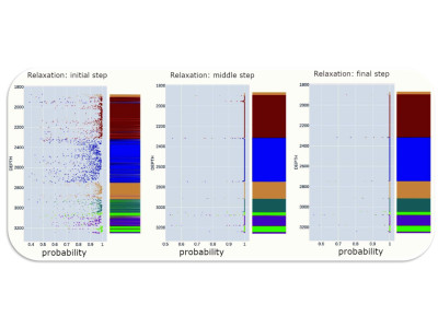
An Active Learning strategy for a well-known image classification problem, classically used in Machine Learning benchmarks.
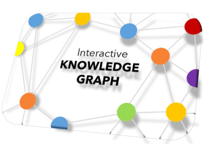
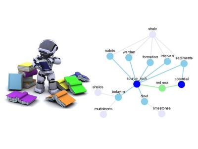
Utilizing a graph view serves as the intuitive method to display categorizations, interconnections between related documents, and meta-information pertaining to the documents.
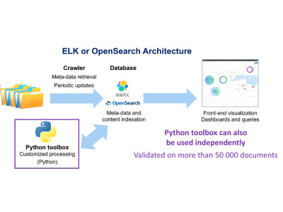
ELK stack with a database / indexation technique for quick searches / dashboards and views.
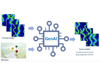
An essential step of risk assessment methodologies in subsurface activities is to simulate multiple possible realizations for the spatial distribution of the lithological facies.
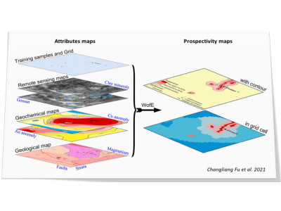
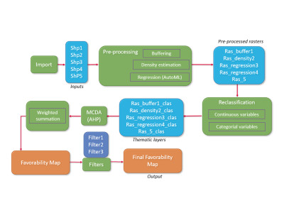
An innovative method to automatically generate maps of prospectivity, based on Machine Learning and multicriteria decision analysis.
A web-based solution, which transforms cement bond logs images into sets of values and interprets them in terms of cement quality in a semi-automatic fashion.
Well correlations can be partially automated to efficiently consider multiple scenarios and better assess the corresponding uncertainties.
Web technologies for visualization of geodata & massive 3D Models
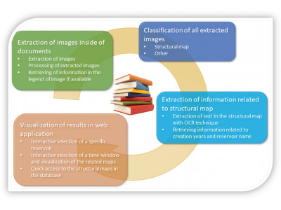
Automatic extraction of images of interest in document database can improve the efficiency of operational workflows and help professionals save time for higher-value activities
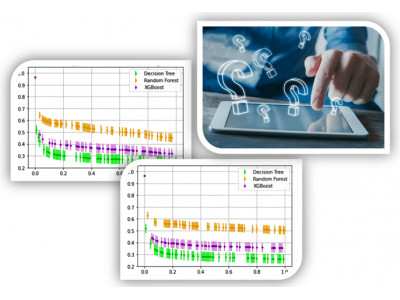
Quantifying the uncertainties associated to well-log data can benefit any decision making based on machine learning workflows where these data are used
Predictive mapping is essential to evaluate underground prospectivity in various fields, such as Oil and Gas industry, Mineral prospection or Geothermal Energy
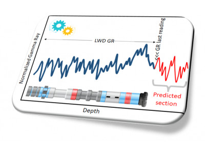
Predicting rock properties while drilling a well, especially if at several tens of meters ahead of the drill bit, can be key to reduce the drilling risks and their associated costs
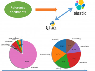
Document classification is one of the major parts of the manual effort, especially when the documents to classify are scattered within a huge database
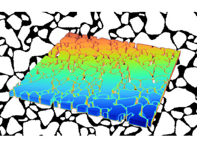
The representation of geological objects in micromodels is often insufficiently realistic
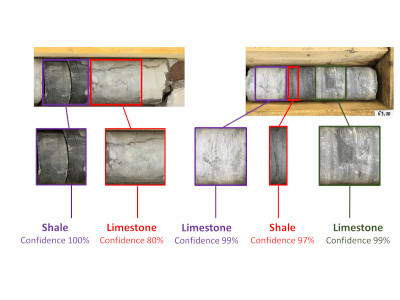
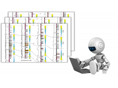
Lithological interpretation of core samples is a decisive early stage of many geoscience workflows
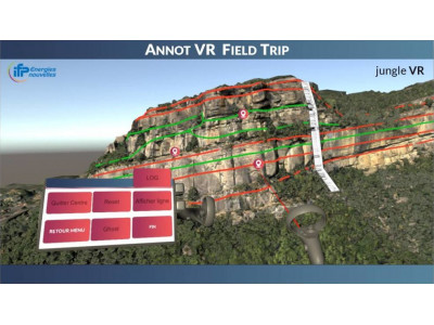
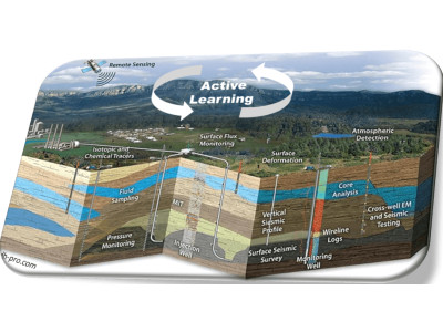
Field trips are increasingly limited by budget, safety, footprint or inclusion issues
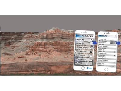
Field data management remains mainly paper-based and is time-consuming
EOR choices are often addressed with circular processes, increasing decision time without necessarily improving final choice
Efficiently searching for relevant information within mass of unstructured data is often a time-consuming prerequisite of scientific tasks
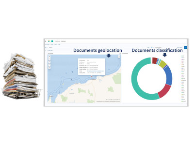
Companies often accumulate very large amounts of documents stored in multiple folders
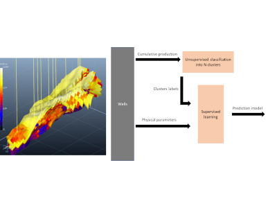
For mature fields, a long history of production data is often available, but the impact of geological factors remains hard to assess
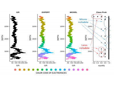
Well logs interpretation is often rather subjective and highly time-consuming
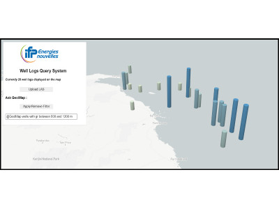
It is often burdensome to handle large amounts of wells files
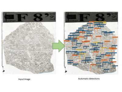
Accurately detecting and locating a large number of objects of interest in thin section images is an arduous task
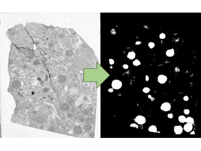
Quantitative analyzes of thin sections often imply tedious searches and counts of specific elements such as micro-fossils
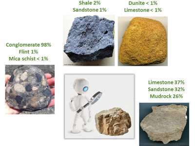
Identification of lithological types from rock samples is cornerstone in many subsurface activities

Development scenarii must optimize production or injection but consider technical and logistical constraints
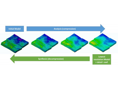
Geomodels usage generates large amounts of data. Model size raises several issues such as visualization, storage, transfer, memory footprint...
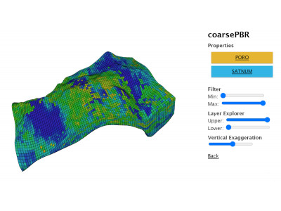
New geomodelling usages require solutions to share and view models independently from proprietary software
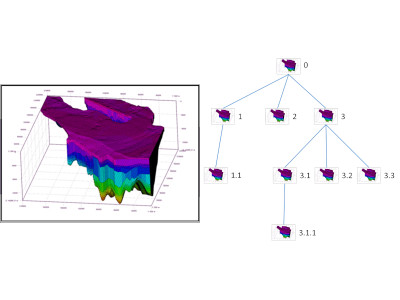
Geomodelling is a long and progressive task. Numerous versions of the model are produced, first in the building phase, then in the calibration one
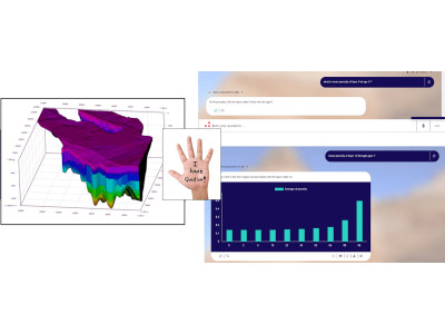
Exploiting geomodelling results is a difficult task due to the amount of generated data. Complex post-processing computations are often required
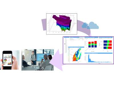
Analyzing geomodels and physical simulation results can be tedious and often involve complex post-processing
Saving...
Image public

Digital transformation
towards geosciences 4.0
