Skip to main content
Navigation principale
What is TELLUS?
Demo projects
NEWS
Contact
Login
Search
Basin
Read more
Datamix python package to process and integrate geospatial data
A comprehensive workflow for managing the multi-step process of producing maps efficiently
Read more
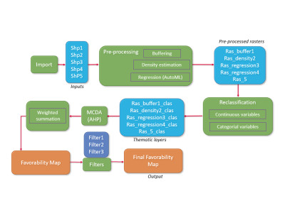
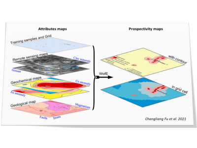
Assisted prospectivity mapping with machine learning and multicriteria-decision analysis
An innovative method to automatically generate maps of prospectivity, based on Machine Learning and multicriteria decision analysis.
Read more
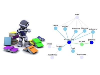
Assisted text mining of geoscience documents
Efficiently searching for relevant information within mass of unstructured data is often a time-consuming prerequisite of scientific tasks
Read more
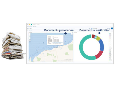
Assisted screening of document packs
Companies often accumulate very large amounts of documents stored in multiple folders
Read more
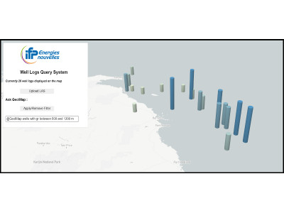
Assisted screening of well data
It is often burdensome to handle large amounts of wells files
Read more
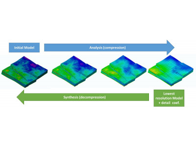
HexaShrink: Multi-resolution rendering and compression of geomodel meshes
Geomodels usage generates large amounts of data. Model size raises several issues such as visualization, storage, transfer, memory footprint...
Read more
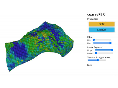
Web viewer for geomodels
New geomodelling usages require solutions to share and view models independently from proprietary software
Read more
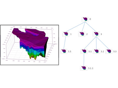
Assisted version management for geomodels
Geomodelling is a long and progressive task. Numerous versions of the model are produced, first in the building phase, then in the calibration one
Read more
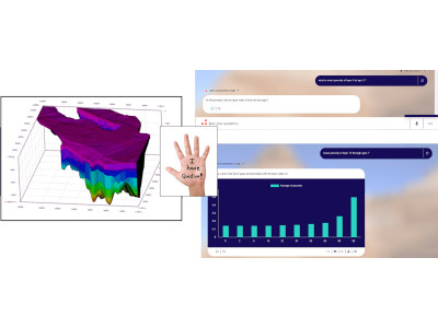
Geomodel exploration with natural language
Exploiting geomodelling results is a difficult task due to the amount of generated data. Complex post-processing computations are often required
Read more
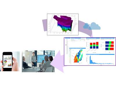
Geomodel exploration with interactive dashboards
Analyzing geomodels and physical simulation results can be tedious and often involve complex post-processing
Read more
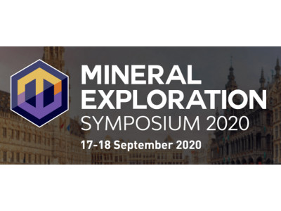
Applications of TELLUS technologies for the mining industry addresses at Mineral Exploration Symposium
The Mineral Exploration Symposium was co-organized by the European Association of Geoscientists and Engineers (EAGE) and the European Commission
Read more
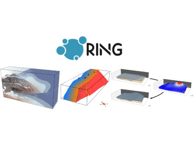
TELLUS projects presented at the 2020 RING meeting
Research for Integrative Numerical Geology (RING) is an international research consortium dedicated to geomodelling and quantiative geosciences
Saving...
© 2025 IFPEN
-
Legal notices