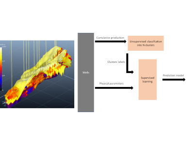
Data integration

An Active Learning strategy for a well-known image classification problem, classically used in Machine Learning benchmarks.
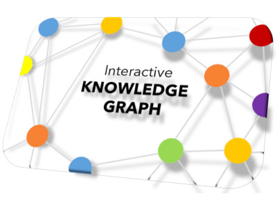
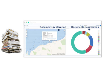
Utilizing a graph view serves as the intuitive method to display categorizations, interconnections between related documents, and meta-information pertaining to the documents.

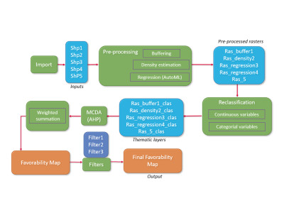
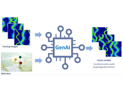
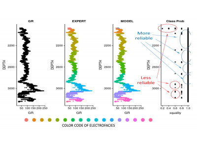
An essential step of risk assessment methodologies in subsurface activities is to simulate multiple possible realizations for the spatial distribution of the lithological facies.

An innovative method to automatically generate maps of prospectivity, based on Machine Learning and multicriteria decision analysis.
A joint publication between the TELLUS team at IFPEN and IFP School addresses the benefits of emergent digital technologies
Field trips are increasingly limited by budget, safety, footprint or inclusion issues
EOR choices are often addressed with circular processes, increasing decision time without necessarily improving final choice
Companies often accumulate very large amounts of documents stored in multiple folders
For mature fields, a long history of production data is often available, but the impact of geological factors remains hard to assess
Well logs interpretation is often rather subjective and highly time-consuming
It is often burdensome to handle large amounts of wells files
Development scenarii must optimize production or injection but consider technical and logistical constraints
IFP Energies Nouvelles (IFPEN) and UNESCO have signed a framework partnership agreement
Saving...