Demo Projects

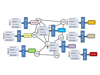
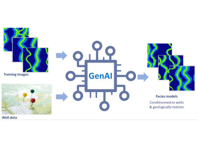
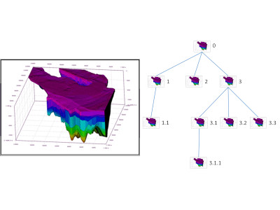
An essential step of risk assessment methodologies in subsurface activities is to simulate multiple possible realizations for the spatial distribution of the lithological facies.

Well correlations can be partially automated to efficiently consider multiple scenarios and better assess the corresponding uncertainties.
Web technologies for visualization of geodata & massive 3D Models
Can the pressure answer of a field be estimated with neural networks in situations of fast decision-making or when a reservoir model is not available?
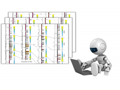
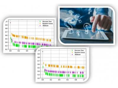
Quantifying the uncertainties associated to well-log data can benefit any decision making based on machine learning workflows where these data are used
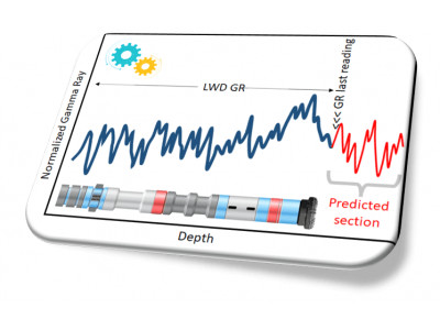
Predicting rock properties while drilling a well, especially if at several tens of meters ahead of the drill bit, can be key to reduce the drilling risks and their associated costs
Efficiently searching for relevant information within mass of unstructured data is often a time-consuming prerequisite of scientific tasks
Companies often accumulate very large amounts of documents stored in multiple folders
For mature fields, a long history of production data is often available, but the impact of geological factors remains hard to assess
It is often burdensome to handle large amounts of wells files
Development scenarii must optimize production or injection but consider technical and logistical constraints

Geomodels usage generates large amounts of data. Model size raises several issues such as visualization, storage, transfer, memory footprint...

Our objectives are to offer both a multi-resolution and compression solution: compression for storage gain, multi-resolution to fit model resolution with the aimed usage.


New geomodelling usages require solutions to share and view models independently from proprietary software
Geomodelling is a long and progressive task. Numerous versions of the model are produced, first in the building phase, then in the calibration one
Exploiting geomodelling results is a difficult task due to the amount of generated data. Complex post-processing computations are often required
Analyzing geomodels and physical simulation results can be tedious and often involve complex post-processing