Demo Projects

Evaluate if the pressure and the production of wells in an oil field can be estimated with graph neural networks
A comprehensive workflow for managing the multi-step process of producing maps efficiently
Automated execution on large datasets and facilitates stochastic realizations, such as Monte Carlo simulations, to generate probabilistic results
An Active Learning strategy for a well-known image classification problem, classically used in Machine Learning benchmarks.

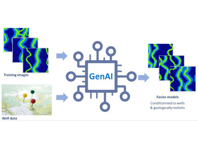
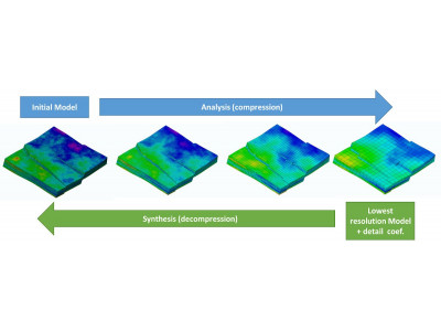
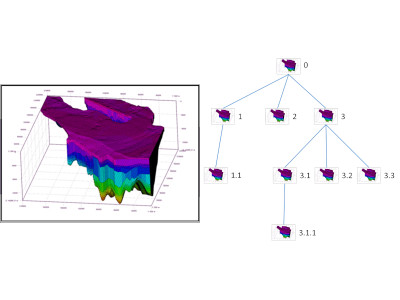
An essential step of risk assessment methodologies in subsurface activities is to simulate multiple possible realizations for the spatial distribution of the lithological facies.

An innovative method to automatically generate maps of prospectivity, based on Machine Learning and multicriteria decision analysis.
Web technologies for visualization of geodata & massive 3D Models
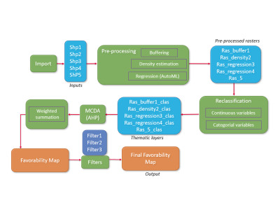
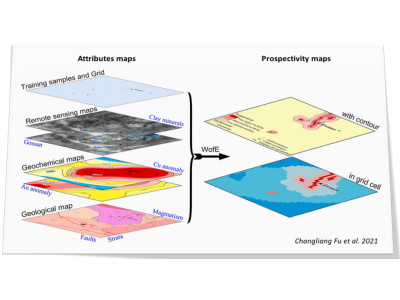
Predictive mapping is essential to evaluate underground prospectivity in various fields, such as Oil and Gas industry, Mineral prospection or Geothermal Energy
Development scenarii must optimize production or injection but consider technical and logistical constraints

Geomodels usage generates large amounts of data. Model size raises several issues such as visualization, storage, transfer, memory footprint...

Our objectives are to offer both a multi-resolution and compression solution: compression for storage gain, multi-resolution to fit model resolution with the aimed usage.


New geomodelling usages require solutions to share and view models independently from proprietary software
Geomodelling is a long and progressive task. Numerous versions of the model are produced, first in the building phase, then in the calibration one
Exploiting geomodelling results is a difficult task due to the amount of generated data. Complex post-processing computations are often required
Analyzing geomodels and physical simulation results can be tedious and often involve complex post-processing