Skip to main content
Navigation principale
What is TELLUS?
Demo projects
NEWS
Contact
Login
Search
Demo Projects
Read more
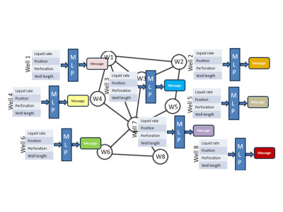
GRAPH NEURAL NETWORKS applied to reservoir engineering
Evaluate if the pressure and the production of wells in an oil field can be estimated with graph neural networks
Read more
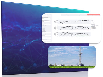
When AI Meets Reservoir Engineering: Time Series Forecasting for Reservoir Engineering
Can the pressure answer of a field be estimated with neural networks in situations of fast decision-making or when a reservoir model is not available?
Read more
Interactive web visualization of massive 3D geodata
Web technologies for visualization of geodata & massive 3D Models
Read more
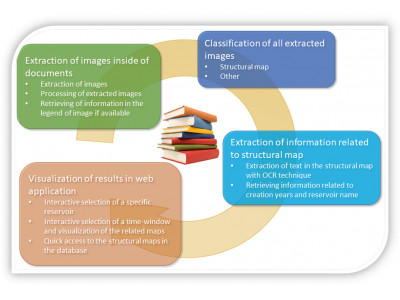
Automated extraction of images of interest in document collections
Automatic extraction of images of interest in document database can improve the efficiency of operational workflows and help professionals save time for higher-value activities
Read more
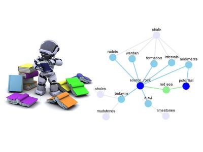
Assisted text mining of geoscience documents
Efficiently searching for relevant information within mass of unstructured data is often a time-consuming prerequisite of scientific tasks
Read more
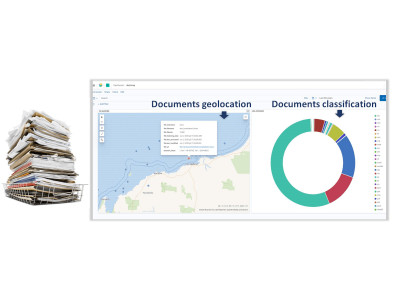
Assisted screening of document packs
Companies often accumulate very large amounts of documents stored in multiple folders
Read more
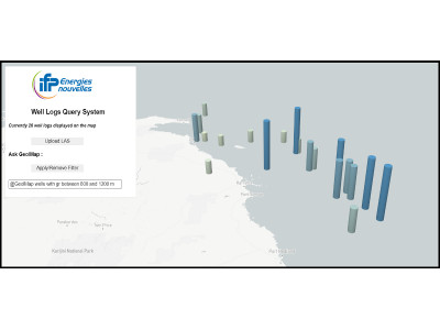
Assisted screening of well data
It is often burdensome to handle large amounts of wells files
Read more
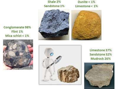
Automated classification of rock samples
Identification of lithological types from rock samples is cornerstone in many subsurface activities
Read more
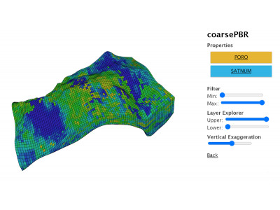
Web viewer for geomodels
New geomodelling usages require solutions to share and view models independently from proprietary software
Read more
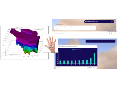
Geomodel exploration with natural language
Exploiting geomodelling results is a difficult task due to the amount of generated data. Complex post-processing computations are often required
Read more
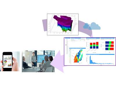
Geomodel exploration with interactive dashboards
Analyzing geomodels and physical simulation results can be tedious and often involve complex post-processing
© 2025 IFPEN
-
Legal notices