Skip to main content
Navigation principale
What is TELLUS?
Demo projects
NEWS
Contact
Login
Search
Demo Projects
Read more
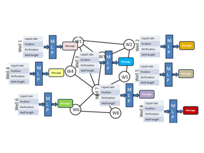
GRAPH NEURAL NETWORKS applied to reservoir engineering
Evaluate if the pressure and the production of wells in an oil field can be estimated with graph neural networks
Read more
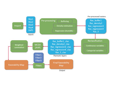
Datamix python package to process and integrate geospatial data
A comprehensive workflow for managing the multi-step process of producing maps efficiently
Read more
Datamix library to register, automate and replay operations on maps and geospatial data
Automated execution on large datasets and facilitates stochastic realizations, such as Monte Carlo simulations, to generate probabilistic results
Read more
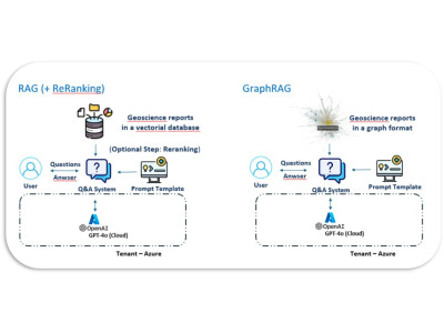
Enhancing geoscience documents mining with LLM through GraphRAG integration and agentic architecture
Developping a robust chatbot that enhances the retrieval and use of geoscientific information
Read more
When AI Meets Reservoir Engineering: Time Series Forecasting for Reservoir Engineering
Can the pressure answer of a field be estimated with neural networks in situations of fast decision-making or when a reservoir model is not available?
© 2025 IFPEN
-
Legal notices